Tokyo, 12 September, /AJMEDIA/
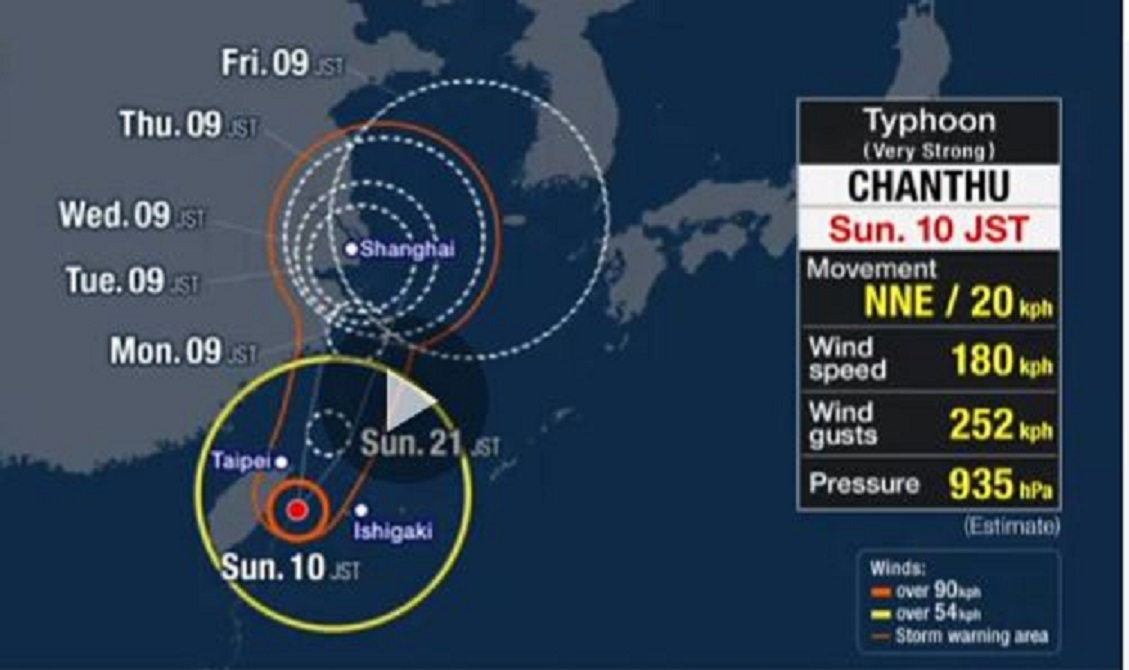
Typhoon Chanthu is heading north and is expected to come close to the Yaeyama islands in Okinawa Prefecture on Sunday afternoon.
Meteorological officials are warning that the typhoon could bring violent winds.
Chanthu is expected to retain its power as it approaches the Sakishima Island chain in Okinawa Prefecture on Sunday afternoon to evening.
Gusts of close to 108 kilometers per hour were recorded at about 9:10 a.m. on Yonaguni Island and over 97.2 kilometers per hour on Iriomote Island.
The officials are advising people to evacuate to a strong building and stay away from the windows.
They say that past typhoons of this level have toppled utility poles and concrete block walls and flipped vehicles onto their sides.
Clouds from the typhoon are beginning to shroud the area. Between 8 a.m. and 9 a.m., 31.5 millimeters of rain was recorded at Miyako airport.
As more developed clouds cover the region, extreme rain with thunder can be expected.
Over the 24 hours until Monday morning, 180 millimeters of rain will fall in the Yaeyama region.
Meteorologists say there could also be lightning strikes and gusty winds.
The typhoon is expected to head toward the continent but is likely to linger over the East China Sea until Thursday as westerlies are blowing further north over the Korean Peninsula.
Chanthu may approach western Japan, including Kyushu, during the latter half of the week, bringing heavy rain.